Fix raytracing origin#1850
Fix raytracing origin#1850ValerioMagnago wants to merge 3 commits intocartographer-project:masterfrom
Conversation
4020ebb to
07c7d28
Compare
|
@ValerioMa this is great to see! One question though, do you have a matching version of cartographer-ros that works with these changes? Maybe I did something wrong, but I failed to build the assets_writer.cc while trying this change. |
|
Thanks @ValerioMa I was using a very similar fix. I am not very familiar with cartographer code, however, I was wondering why you choose to not add the origin to Also, it looks like you should updated |
Adds the laser ray origin to `RangefinderPoint` to enable
correct raytracing of range data misses into a 2D probability
grid also after scan accumulation.

Previously, all rays were casted from their hit point to the
tracking frame. This is wrong for any setup where the tracking
frame is not the sensor frame and leads to artifacts in the map.

Fixes: cartographer-project#947
Signed-off-by: Valerio Magnago <magnago@magazino.eu>
Before the origin was not taken into account when comparing RangefinderPoint.
This commit add the comparison of the origin when comparing two RangefinderPoint.

Signed-off-by: Valerio Magnago <magnago@magazino.eu>
4064c22 to
611a5fc
Compare
|
@tulku thanks for your suggestion and sorry delay! Regarding the TimedPointCloud I left it without the origin because for that purpose we have the TimedPointCloudOridinData. |
Adds the laser ray origin to
RangefinderPointto enablecorrect raytracing of range data misses into a 2D probability
grid also after scan accumulation.
Previously, all rays were casted from their hit point to the
tracking frame. This is wrong for any setup where the tracking
frame is not the sensor frame and leads to artifacts in the map.
Fixes: #947
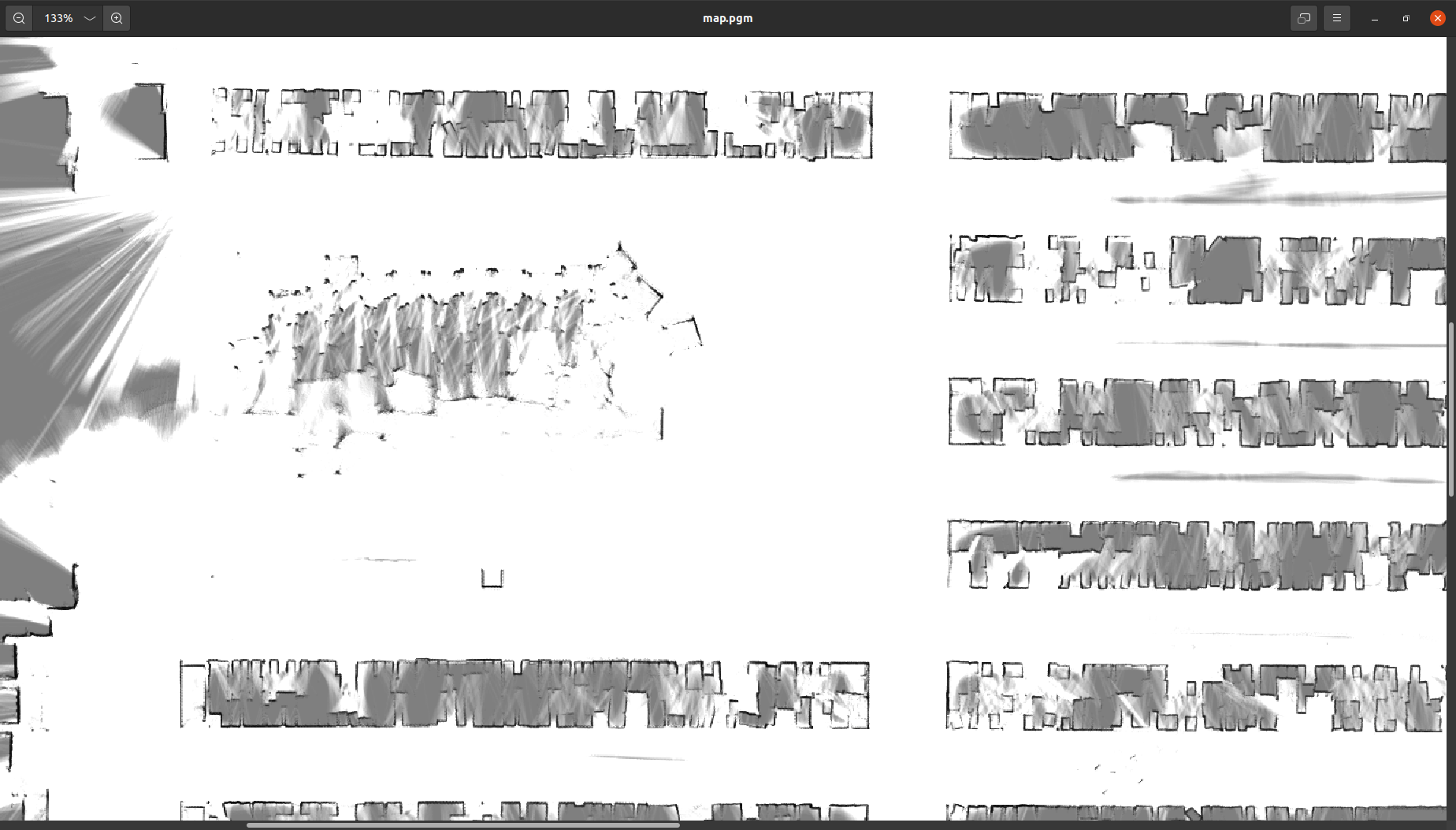
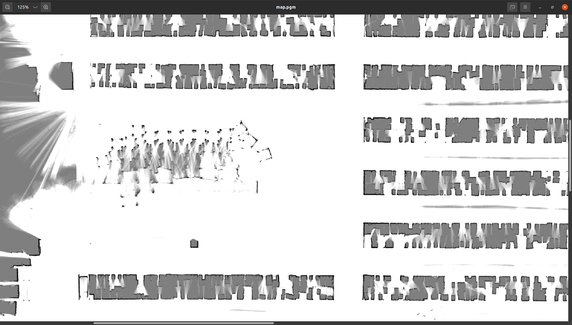
Below an example of a map generated from a multiple 2D laser scanners configuration, which are not centered in the tracking frame, before and after the proposed fix. It can be seen clearly that the previous version of the software was cutting and cleaning the corners of the map due to the imprecise origin used for raytracing. This caused the exclusion of large structures from the map.